
Route start: Bellreguard, formerly Sotaia
Route start: Bellreguard, formerly Sotaia
Sotaia is a name of Arab origin, and it relates to the former morisco alqueria (farmstead) located somewhere in the area named after it. It would later become the Christian town of Bellreguard.
In his work Diari de Sotaia, Joan Pellicer shows us the simplicity of life, the wonders of nature, of the landscape… praising the plants, animals and the people. He describes his daily life over the course of a year in a simple, poetic and charming way, with wonderful treasures; it is a work of careful observation, scientific research and literary creation.
Sotaia is his birthplace, his village, the fields he has trodden since he was a child. He knows the land inch by inch, and yearns for it when he is away. Pellicer defines himself as “…Veí de la muntanya. Company del barranc, de l’avenc i de la cova, del corb, del tord i de la sargantana, del fenàs, de la molsa i de l’aranya, del cingle enaltit i pacífic i de la font. Tot el dia caminant per forcalls i mallades oblidades i passets de cabres i corriols de senglars, i a tot volt la garriga i la pedra amigues, els dits de l’aire i el bes del sol”.
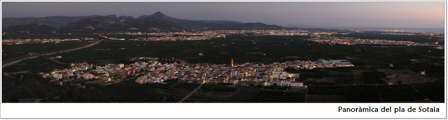
The lands on the Palmera ravine’s left bank and the lower part of the old road from La Font to Gandia (that is, La Runa, La Vega and Els Olivars), are part of a large area called the Sotaia plain, or simply Sotaia, extending over the municipalities of Rafelcofer, Beniarjó, Almoines, Alqueria de la Comtessa, Palmera and Bellreguard. The name of Sotaia has its origins in the Arabic word Sutayha, which means “terrace, paved area, or oil mill’s basin”, and is the root of the Spanish word “azotea” (flat roof or rooftop).
In 1486, Bellreguard was acquired by Pere Lluís de Borja, Duke of Gandia. The name of Bellreguard appears for the first time replacing Sotaia in a deed of that time, being the solicitor the writer and theologist Joan Roís de Corella.
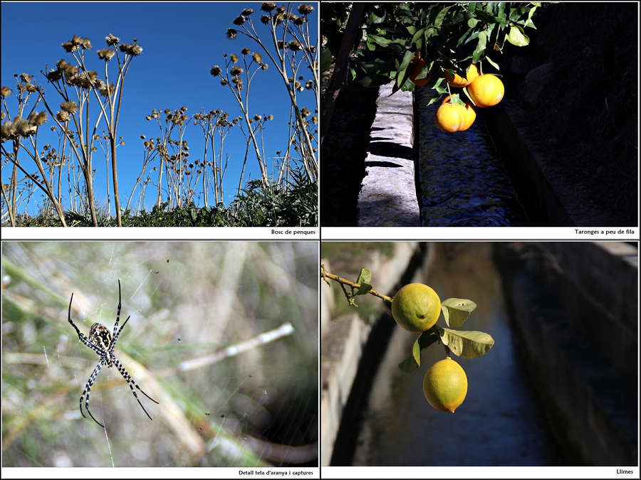
During the 16th and 17th centuries, the economy of this area was based on the cultivation of sugar cane, mulberries and vineyards. Later, orange trees would become the main source of wealth.
“Poble pla i hortolà, senzillament, amb el meravellós regal d’un esquinç frondós de marjal i un braç de mar… Bellreguard és només i senzillament un poble de pla de l’horta. Però si hi ha un poble saforenc que resulte ràpid i ineludible de descobrir de qualsevol cim o puntual de les muntanyes que envolten la comarca, amb el seu clar i dreçat campanar, enlairat al bell mig de la paradigma fronda de la plana d’horta de tarongers, oberta a l’ample ventall de la mar, i des de la qual millor s’aprecie amb equidistància tota la redonesa i grandiositat de l’arc de roca viva que n’arrecera…. aquest és Bellreguard.”
Joan Pellicer i Bataller
Bellreguard, verd esguard.
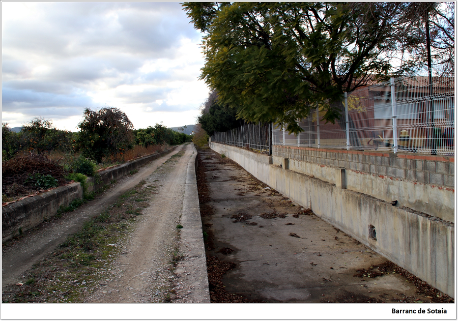
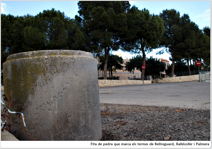
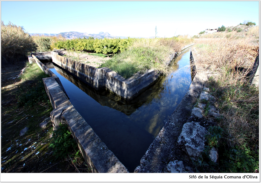
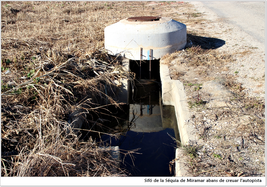
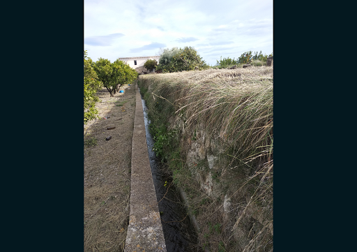
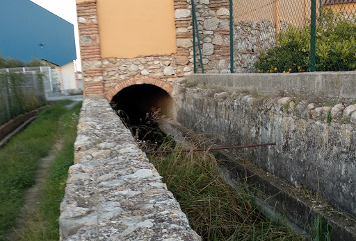
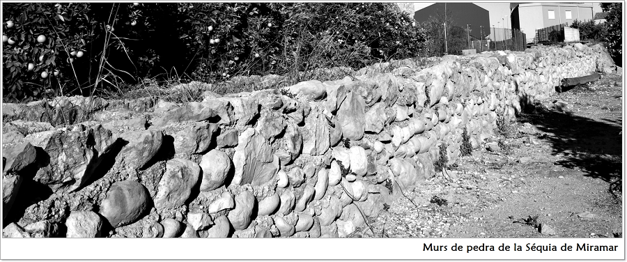
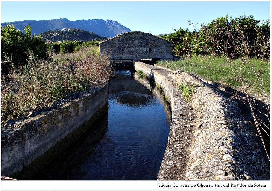
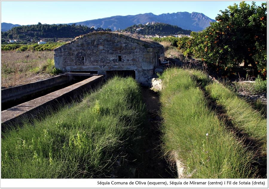
Start of the route: Sotaia ravine (also Barranquet or Bellreguard ravine). It runs south of Bellreguard, along the border with Palmera and Rafelcofer, flowing into the Miramar Canal. The Bellreguard segment is channelled by masonry walls. At this point there is a boundary stone marking the limit of the three municipalities.
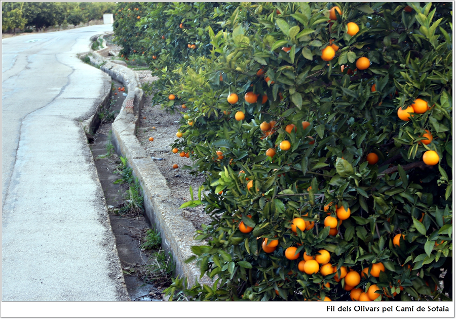
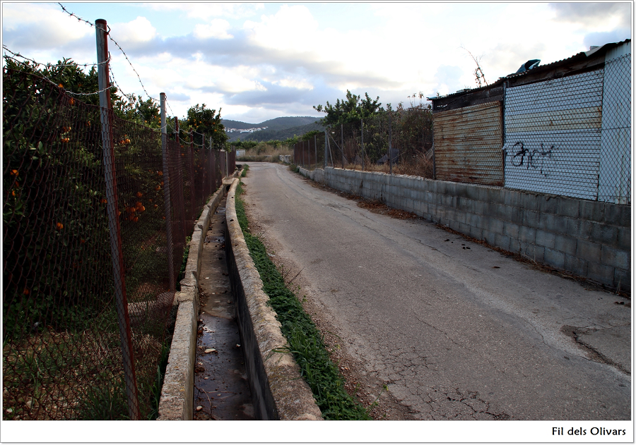
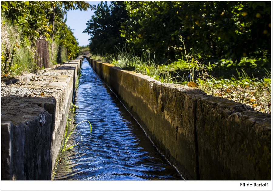
Fil dels Olivars
Fil dels Olivars
As we walk along the Barranquet path, we see to our left the Fil dels Olivars, which runs into the Sotaia ravine, and will accompany us winding for about 350m among citrus groves, where we will turn right following the Sotaia path (or Olivars). This fil (thread) flows along the path. It has two traps, and irrigates the Olivars allotment for almost one kilometre. Once in the old road from Gandia to Rafelcofer, we will see the point where it diverts from the Miramar Canal.
Formerly, it was known as Olivar del Duc (the Duke’s olive grove, 1638), as it was a manorial property: olive groves administered directly by the Oliva County initially, and the Gandia Duchy, afterwards.
What is a fila (or fil) of water?: It is the volume of water that flows through a ditch of one squared span, over a certain amount of time with regular or constant speed along a fixed distance; it can be defined scientifically as the flow of water running with uniform speed a distance of one vara (3 feet) over one second; or also as the volume of water that flows through a horizontal conduit of one cubical span, and can fill 3 water jugs completely.
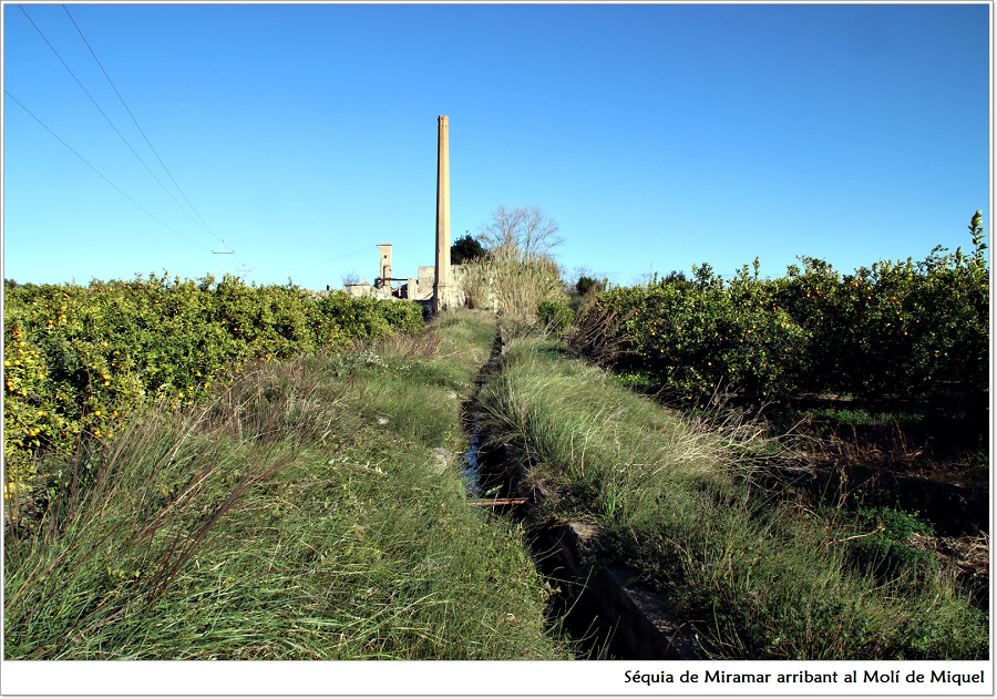
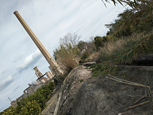
Miquel Mill – The bulrush
Miquel Mill – The bulrush
Close to Miquel Mill, we find a copse of giant, magnificent, wild trees. Each of them provides food, shelter and hideout to many birds. This leafy place is ideal for the observation of wildlife, especially the birds that fly freely around the fields. This is how Joan Pellicer describes these little birds:
Canta i campa pertot el pit-roig, el reiet tardoral dels termes. Quina amable companyia els aucells de l’horta! Quina amenitat. Quina exquisidesa. Quin temps més fructuós el viscut entre el verd i els animals! Verderols allimonats, cues-roges, palputs espectaculars i exòtics sobrevolant els cimals de la fronda, cues-blanques refiades i atrevides saltironant pels caminals, merlots de bec daurat ocults en la verda ombra, saltamarges i sits pels canyars, cues-grogues tímides i fugisseres als bassals, els pintats pinsans, els xerraires gafarrons, les llistades sitres, els mudats totestius, les colorades caderneres… També el martinet de riu, el nostre blauet irrompent fletxat d’una séquia amb els seus ullots esbatanats i la seua breu i bellíssima cua blava esmaltada. I a les altures, vigilant i inquiet, el rei principal, el sobirà de l’horta i les marjals, l’esparver, el roig soliguer que planta i guaita la caça al grat de l’aire lleu.
Hi ha els darrers xerroteigs i comentaris d’aucells. Un arcaic i acollidor clamor de fins i breus acords sobreeixint de la silent fronda. La màgica bondat de l’horta. La seua plàcida i serena solitud. Aquest primal i subtil assossec dels camps. Aquesta pau vibrant, lleu i fonda. Aquesta gràcia estremidora i íntima.
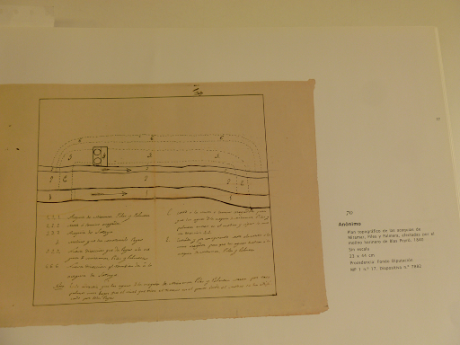
The mill, located in the Sotaia (or Calaixet) allotment, receives the waters coming from the Sotaia mill through the Miramar Canal. It has two falls of 110 cm in diameter and 3 m height, without a millpond. In the beautiful basement we find two wheels and two Catalan millstones, used to grind corn and rice. It preserves the chimney where chaff and almond shells were burned to strengthen the water stream thanks to a rudimentary gas motor. It was built around 1856, although a first project was presented in 1840 by Blai Peiró, owner of the Alfàs mill in Potries.
The project and a sketch of the mill in 1840 can be found in the Gandia Archive.
In 1927 it was known as Calaixet mill, because it was located in the Calaixet allotment. It ceased to operate around 1962. The owners were the Peiró Barber brothers, Fabià, Vicent and Miquel. Later, it was inherited by the sons of Miquel: Antoni, Alfons, Miquel and Fabià Peiró Castillo. In 1941 the owner was Josep Peiró Castillo. Its last owner as a mill house was Miquel Peiró Castillo. It was used to grind rice and flour, but in the last period it only ground rice.
A fire in 1998 destroyed completely the roof and the inner structure of this large mill house, but fortunately the outer walls still remain.
The name Calaixet appears misspelled as Carraiset in many notarial deeds of the mid-19th century. This name refers to a hollow in the Miramar or Beniamís canal, where the fall of the watermill was installed in the 19th century, and where bulrush was very abundant: an aquatic plant whose dried rushes were woven to make chair seats.
USES OF BULRUSH
The bulrush (Typha latifolia) is a large herb that roots in the water. They are normally found on the edges of calm water streams, ponds or basins.
Year after year, the bulrush grows and multiplies forming a sort of islet. Bulrushes are an excellent shelter, as well as a nesting and breeding area for many aquatic birds. It is easy to see fishes around them, searching for little insects.

Molí de Miquel prow bifurcation
Molí de Miquel prow bifurcation
Placed near the Molí de Miquel, the function of this bifurcation is to divert a thread to irrigate the El Bartolí citrus groves, in the municipality of Palmera. It is a wedge-shaped element made of plastered cement, with a rounded edge, facilitating the flow of water by reducing friction. At both sides of the wedge there are grooves where wooden or metal panels can be fitted. The purpose of these elements is to distribute the proper stream to each canal. The volume of water required varies depending on the capacity assigned to each one and the irrigation turns.
From this point, the Miramar Canal gets into the Molí de Miquel, and the Fil de Bartolí irrigates the surrounding citrus lands.

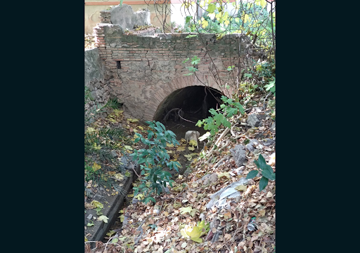
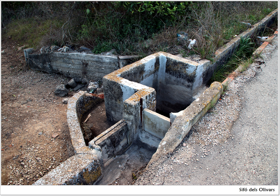
Olivars Trap
Olivars Trap
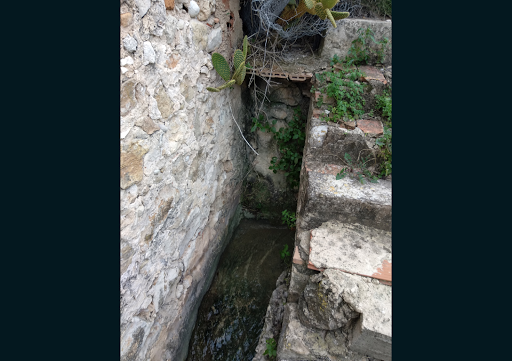
The Olivars Trap is in the Olivars allotment. It was built so the Fil dels Olivars could cross from one side of the road to the other. It is squared and of small dimensions (1.10 m on each side and at ground level).
The trap is a water conduction device that allows the water to flow across an obstruction or height difference. It is based on the law of communicating vessels, and consists of a U-shaped, usually underground channel, typically constructed with prefabricated cylindrical parts.
These traps have been rebuilt continuously over the centuries. Because of this, it is not possible to accurately assign a construction date to them, by the simple observation of their elements and materials.
Formerly, the traps in the canals consisted of conduits made of hollowed logs or other easily degradable materials.
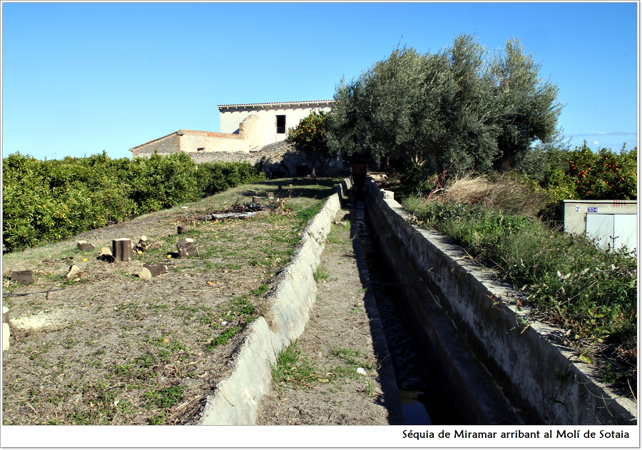
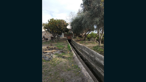
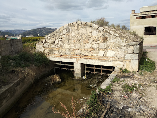
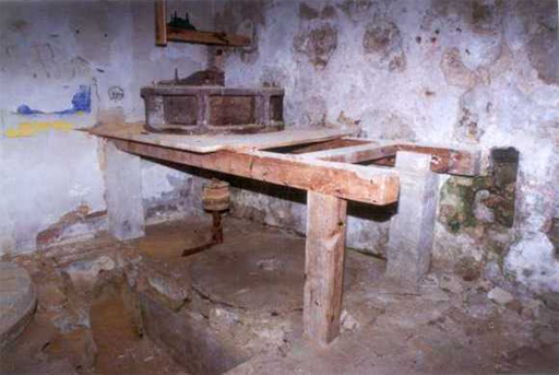
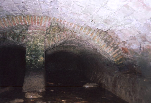
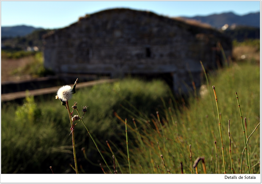
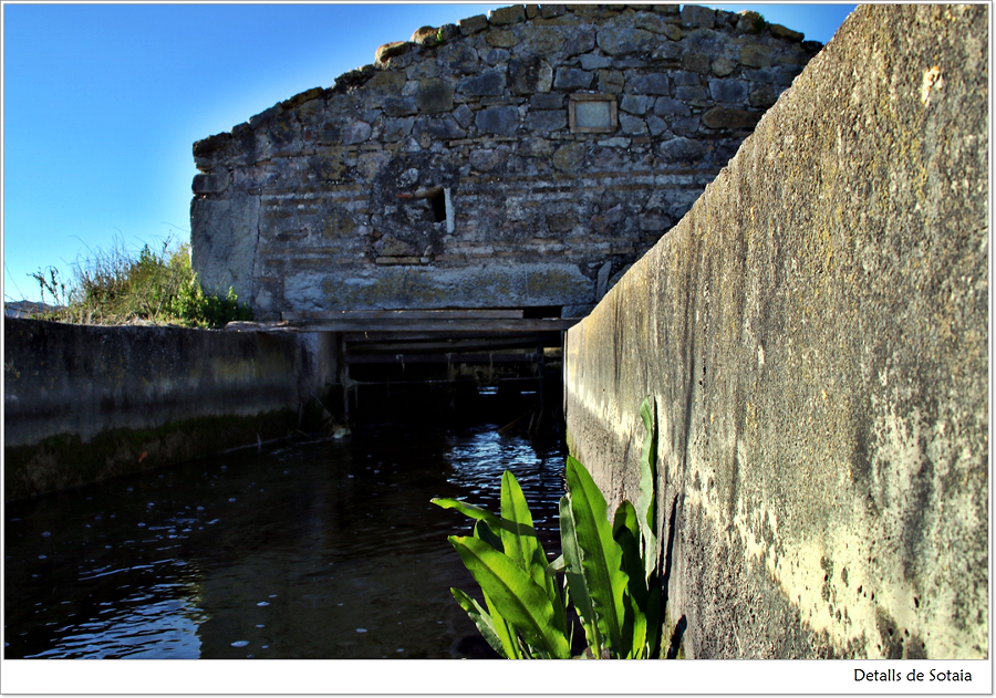
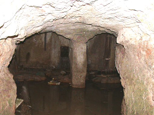
Sotaia Mill
Sotaia Mill
It is currently a private home, located in the Sotaia allotment. The mill received the water through the Miramar Canal, which diverted from the Cano in Potries. It had a small pond, two falls, two vaults, three wheels and three millstones. This mill provided water to the Miquel mill by the same canal.
It was built between 1840 and 1841, after a long period of disputes among the irrigators of Piles, Palmera, Miramar and Alqueria de la Comtessa. They were convened by their town councils on December 18, 1839, in order to address their concerns to the civil governor of Alacant (at that time the land belonged to the province of Alacant), since the waters were taken from the Miramar Canal.
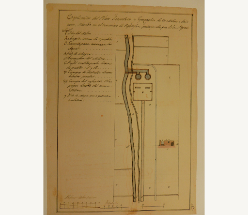
According to a plan of the mill and its surroundings from 1863, the owner was Vicent Part Frasquet.
It was also known as Fabrilo mill, named after one of its owners, Vicent Barber “Fabrilo”. The next miller was his nephew Antoni Vicent Barber Part, who was helped by Salvador Peiró Escrivà. Salvador was married to Antoni’s niece and heir Consol Barber Solbes. They operated the mill until 1967. In 1970, the mill was already closed, and it was bought by Vicent Faios Bataller, from Pobla del Duc. He wanted to turn it into a farm, but now it remains inactive. It is only used as a private home.
In the Gandia Archive there is a map of the mill and its surroundings in 1863.
“Els animals com són: feréstecs, enjogassats. Les plantes així mateix: humils o solemnes, secretes i formoses sempre. La roca, dreta, rotunda. L’aigua, amb la seua suavitat i la seua puixança. El vent, ara furiós, ara tendríssim. El foc, sempre bell i perillós. La nit darrere el dia. La primavera, darrere l’hivern. Els crepuscles, les rosades, les illes, els núvols, les coves, les platges, les tempestes, els astres…
Cel esglaiat fins al migdia, i llisor de blau tota la vesprada. El llebeig ha baixat i a mitjan matí ha entrat el vent del nord, una tramuntana temperada però tallant i freda. Així com hui, xicoteta, la tramuntana és perfecta. Bòrees, vent d’altures, de boscos, de neus perpètues, magnífic, pur. No és una meravella aquesta terra on el vent del nord arriba quasi sempre amb les urpes plegades, inofensiu, oferent, amorosit, tonificant, nodridor, salutífer?”

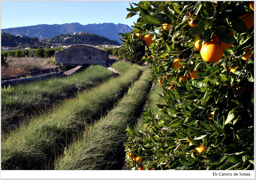
A sea of orange trees
A sea of orange trees
“Camí de Benirrugat. Boqueta de nit. Plàcida brisa terral. El terral prim de sempre. Salten llàdrucs del molí. Sent els primers grills de la primavera, olorant les també primeres dolces alenades de la flor del taronger. Pels tarongerars, horta avant, pel verger de Sotaia.
Les olivardes tornen com tots els anys a guarnir de groc els caminals, camins i carreteres. Les olivardes garrides, batalleres, tenaces de fulla vulnerària i floretes solars.
Seguir, caminar, ser aire i carn de sendera.
Quin error ignorar el plaer de caminar tranquil, lleuger i dret.
A Sotaia de nou. Sotaia verda i florida, verger entre vergers al bell mig d’una gegantina corona blava meitat roca, meitat aigua.
L’amor continua sent el més atraient i més temut, el més enaltit i més sollat.
L’amor és l’estat de màxima receptivitat i generositat.”
As we walk across the sea of orange trees, we appreciate the succession of groves irrigated by countless canals and ditches, the concatenation of rectilinear rows of trees drawing geometrical structures, and the explosion of colours and scents from the orange blossoms and oranges.
In fact, many Valencian poets have dedicated verses to the orange tree and its fruit.
Francesc Almela i Vives wrote:
Taronja: forma redona
com una faç d’abadessa.
Taronja: color bufona
com una flameta encesa.
Taronja: sucre en esponja
de canem i satalies.
Taronja: menja de monja
amiga de llepolies
Taronja:
qui en menja se torna flonja […]
The orange groves form a true “cultural forest”, as an authentic green lung in the region of La Safor. It is not only an agricultural space, but an extensive ecological system in which natural and cultural processes interact in a supportive way. The agricultural matrix, where citrus groves predominate, maintains an open canopy extension, which, besides being very productive, helps to fix carbon dioxide and serves as a refuge for animal species.
The canals and ditches of the dense irrigation network act as the arteries of the fields and villages, moving biotic and abiotic flows; runoffs and natural vegetation form an ecological corridor over the green mantle.
Drovers’ roads
The road along the Miramar Canal was a drovers’ road. It was used to drive flocks and transport crops and farming products.
The drovers’ roads or droveways were wider than other roads and had public right of way. They used to go through the easiest terrains, always close to springs, wells and drinking troughs. These ancient routes of our territory coincide with many of the current rural roads. All of them are protected by the 16/2/93 Decree issued by the Environmental Department.
The drovers’ roads, which can serve as ecological connectors and include different recreational uses (walk, hiking, mountain biking, horse riding), together with the elements associated to them (rest areas, drinking troughs, counters or bridges) constitute an important historical and cultural heritage in our region.
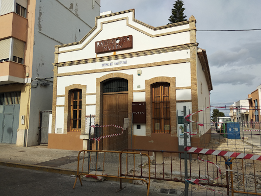
Racó Pump (or San Diego Pump)
Racó Pump (or San Diego Pump)
Normally an irrigation system has a gradual decrease in altitude between the origin (usually a river) and the end of the circuit, which is often the sea. However, sometimes it is necessary to speed up or elevate the water artificially. This can be done using norias, as in former times, when animal or human traction allowed to lift water from a lower elevation, or also with a system of sluice gates, like the ones used to irrigate fells or elevated terrains.
The motors or pumps were introduced in the 20th century. These fulfilled the same function, lifting the waters of the lower canals, and allowing the irrigation of higher terrains. They could also give greater strength to the stream of the original canal, which was (and still is) the purpose of the Racó Pump.
In Rafelcofer we find two historical motors, the Racó Pump and the Caragol Pump, which provided water to the Oliva Common Canal and the canals of Sotaia. The Racó Pump is located in the urban center, on the Avinguda de Xàtiva, and it irrigates the Racó allotment fields.
The building of the Racó Pump, recently restored by the local council, houses at present the Ethnological Museum of Rafelcofer
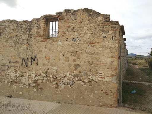
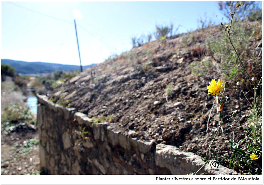
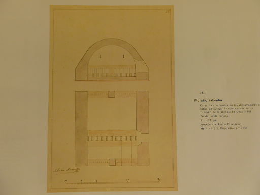
Alcudiola Mill
Alcudiola Mill
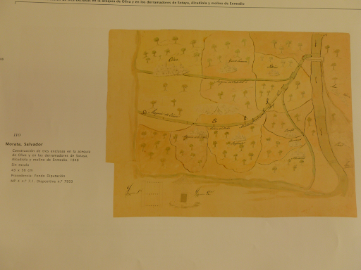
This was a remarkable ethnographic ensemble, torn down definitively in May 1997. It was fed with the waters of the Oliva Canal, which starts at Casa Clara, and passes through the Cano bifurcation in Potries and the Alcudiola bifurcation (1849). The latter is located 50 m before the mill, where a ditch is diverted to irrigate the Rafelcofer fields.
It was located in the Racó allotment. Without a millpond, it had two falls of 136 cm in diameter (with two holes) and 126 cm (with one hole), about 4-5 m height, water inlets of 100 x 120 cm, two vaults more than 2 meters high, four rollers and four millstones, three Catalan stones for corn and a French one for wheat. An electrical system and new machines were installed in 1935. Gregori Maians mentioned it in 1745 by its name.
This mill had an Arab origin, as it appears so in a royal donation to the new settlers after the conquest. Its location, near the old Roman Road that connected the cities of Saetabis (Xàtiva) and Dianium (Dénia), as well as different Roman archaeological findings in the Rabat area in Rafelcofer, suggest that this mill could have been first erected by the Romans, as is the case of the Molí Canyar in Potries.
Before its demolition, it still conserved many structural elements. The owner was Francesc Pérez Gil, or tio Paco, and the millers were his nephew Francesc Pérez Castellà and Vicent Serrano Gregori.
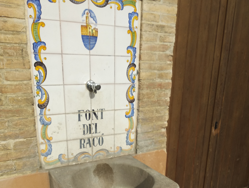
Alcudiola (or Racó) bifurcation
Alcudiola (or Racó) bifurcation
This water distribution house is located in the municipality of Rafelcofer, in the Racó allotment, on the edge of the urban nucleus. Its function is to divide the waters between the Oliva Canal and the new Fil del Racó, which irrigates the homonymous lands. It is made of dry stonework and has a rectangular floor plan. It has a small door and iron fences in the entry and exits of water. It was remodelled in 1849, as reflected by a mark engraved in a central stone on the front wall.
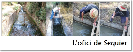
The sequiers in the 19th century.
The sequiers were the people designated to manage and take care of the traditional irrigation system. Their function was to go across the assigned canals and ditches in order to control the water distribution, according to the irrigation turns. They also reported to the judge or mayor of the town those water usurpations or other infractions they might observe. They had the right to get a third part of the fines imposed on the offenders. The penalties for ordinary infractions were usually of 3 Valencian pounds if it happened in daytime, and 6 if it was overnight. Infractions in the royal and major canals amounted to 25, 50 and 100 pounds, and 400 pounds for the dams, according to decrees of the Royal Territorial Court.
The emblem of the sequiers was a twelve-span long rod, with an iron hook at the end, which was traditionally named the “dall” (scythe).
The first "highway" in La Safor: Camí Vell de Xàtiva
The first “highway” in La Safor: Camí Vell de Xàtiva
The CAMÍ VELL DE XÀTIVA (Old Xàtiva Road) was an Iberian route connecting the city of Xàtiva and the port of Dénia. It was a secondary branch of the Via Augusta, which linked Rome to Cádiz across Valencian lands. From Tarraco, it passed through Saguntum, Valentia, Saetabis and Ilici, and it continued towards Andalusian lands.
Most of this branch would later coincide with the Camí Real Xàtiva-Dénia, which in the 18th century, unlike the Roman road, passed through the cities of Gandia and Oliva. A significant part of funerary epigraphic inscriptions and the remains of necropolises and burials are found alongside this route, such as the Iberian site in the Rabat mountain (the Rabat was occupied at least between the fifth and first centuries BC, with four hundred years of activity. In this site were found Iberian and Roman coins from the late-Roman period, ceramics from ancient Greece and objects used to weigh merchandise); and also the Roman villa on Sant Miquel hill (excavations made in the 19th century confirmed the existence of a rustic villa, uncovering some monumental architectural remains such as capitals and column shafts. Different numismatic pieces and ceramics -tablewares imported from northern Italy (Arezzo) and southern France (La Graufesenque), and the kitchenware, of African origin-, reveal the short life of the site: from 30-25 BC to 60-70 AC).
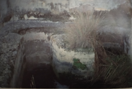
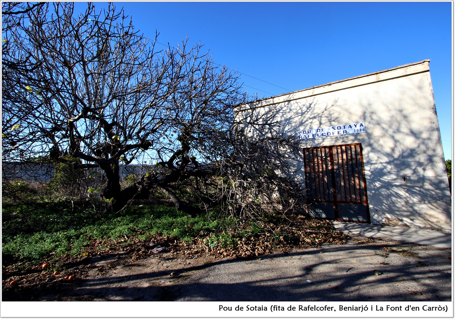
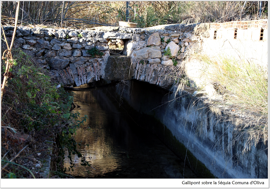
Sotaia Well
Sotaia Well
The well itself has little interest, since it is a 1980 construction. However, we can see clearly its lifting function on its back side, where different “galliponts” or elevated conduits are layered at different heights, crossing over the Miramar Canal, to irrigate the surrounding lands, much higher than the main canal.
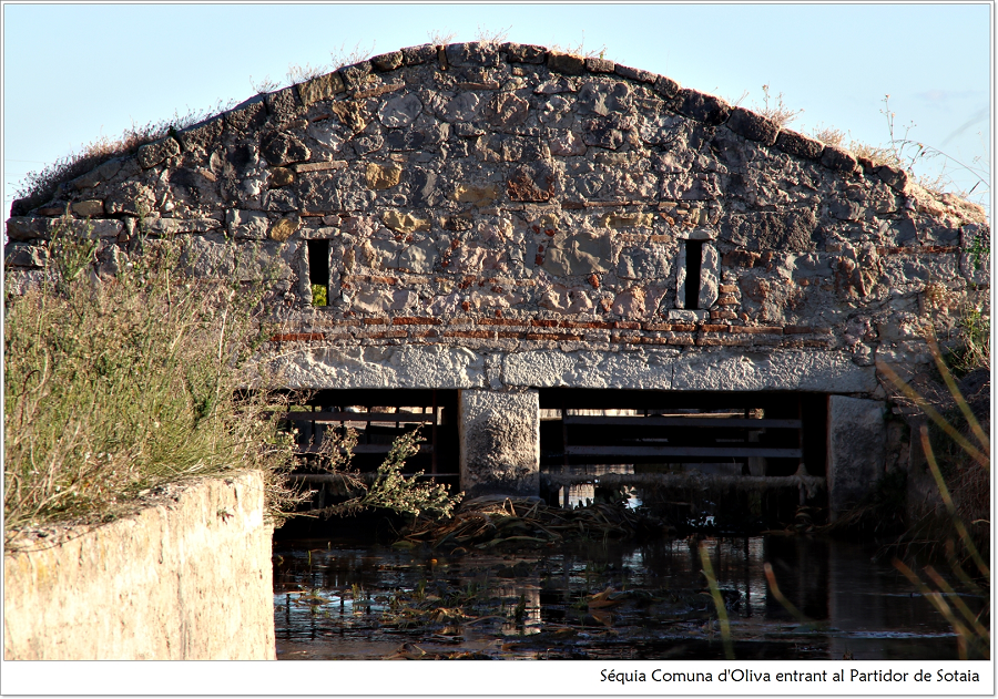
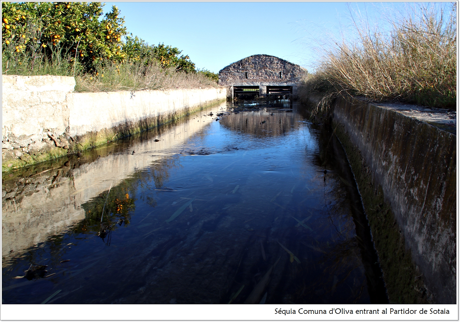
Besides, it is a significant spot in our route, since it is a tripoint border of three municipalities (Beniarjó, Rafelcofer and Beniflà), where the Miramar and Sotaia canals, which ran in parallel up to this point, split off forming the Sotaia allotment, which extends over the municipalities of Rafelcofer, Bellreguard and Alqueria de la Comtessa, as well as parts of Beniarjó and Almoines.

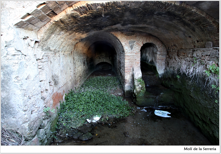
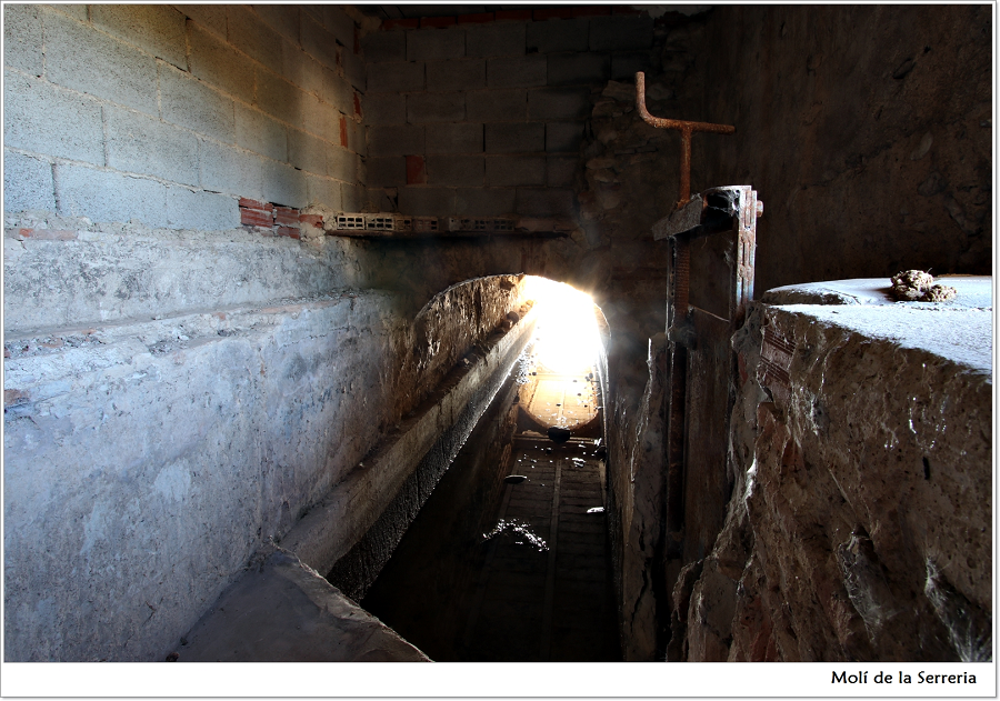
Serreria (or Llum) Mill
Serreria (or Llum) Mill
The Serreria Mill (also Batistet, de la Llum) is located northeast of Potries, bordering with Beniflà and la Font d’en Carrós municipalities. Today it is a completely restored private house. It was a state of the art industrial building, probably built in the late 19th or early 20th centuries. It receives the waters from the Potries bifurcation or ‘cano’, located about 300 m before. It is at a distance of about 2000 m from the Molí Canyar and 400 m from the Molí dels Anouers. The energy is supplied by the waters of the Miramar Canal, which then run to the Molí de Sotaia. It did not have a millpond but a 4 m fall moving two wheels and two Catalan millstones 138 cm in diameter and 28 cm in height, which ground wheat and corn to make flour and bran. The basement is beautiful, with two compartments, one for the flume and other one for the chamber itself, about 3 m high, 2 m wide and 4 m long.
Originally it was used as a flour mill. Then the Adrover Company added to it a 17 hp turbine to supply for the first time electricity to Beniarjó and Beniflà, in 1907. This turbine also powered the millstone, both of them are all still conserved today. For some time it worked as a sawmill. From the 1922 it became a starch factory. However, it continued being a grinding mill in parallel to all other activities. It was owned by Agustí Miret Mayor, neighbour of Gandia. It kept grinding until 1955, when the person in charge was Baptista Montaner Soldevila. His sons Baptista and Francesc Montaner Orovay were the stonecutters that made the millstones of the Llum, Tola, Canyisset, Anouers, Alcudiola, Sotaia (or Fabrilo) and Beniflà mills.
Ara per tot broten noves herbes, i no són poques les que hi ha florides. Encatifant els horts i els tarongerars, els suaus i tofuts agrets amb l’enigmàtica flor de la cresolera entremesclada, els ravenells florits, els mercurials, el mascle clar i la femella fosca, discrets tots dos i enamorats; la modesta caüla; la jove florida de les fràgils i encisadores fumàries; la humil blancor dels pixagossos; la centaura negra esbadellant la seua porpra nova i les brillants i jovials rosetes i brots nous dels llicsons, les cama-roges, les dents de lleó, les malveres, les agullones, els geranis lluents, la pradella, els blets, els quenopodis, el cànem bord, les calcigues, els cards tacats, els ranuncles, les viboreres, la bracera, els plantatges, les llengües de bou, les coletes els melerets, les aristolòquies, les corretjoles, els panicals, les ortigues, els grams, els serreigs, la junça, l’all porro, els porradells, les porrines…
Banderí Pump
Banderí Pump
This pump is located between the Serreria Mill and the Anouers Mill, at an altitude of 46 metres above sea level, and contributes to the irrigation of the Oliva Common Canal and its diversions in the Huitena and Anouers allotments.
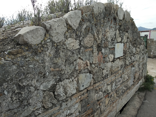
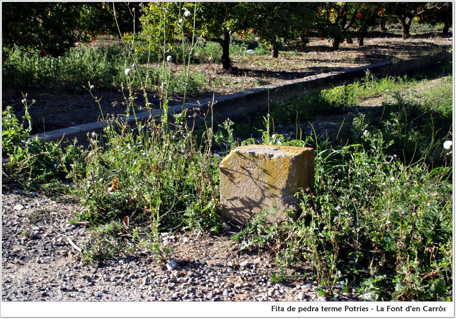
Boundary stones
Boundary stones
For a long time, there has been a need to mark places, especially properties and fields, in order to delimit their boundaries. The best way to mark them was to use large or singular stones, with lime mortar, stuck into the ground, making it difficult to move them.
On the way between the Serreria Mill and the Anouers Mill, we can see several boundary stones, which in this case have a triple function: to demarcate the different fields, the line of the road and the border between Potries and La Font d’en Carròs municipalities.
These boundary stones are short and rectangular, though we can still find some conical ones of almost one metre in height with the same function, such as the one placed between Potries and Beniflà, where the canals of Sotaia and Miramar start to run in parallel.

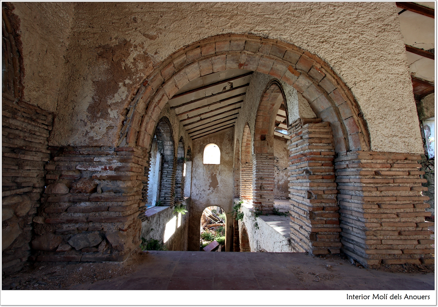
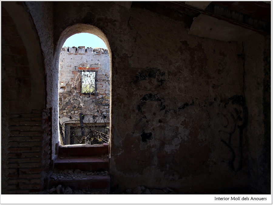
Anouers Mill
Anouers Mill
The Anouers Mill (Walnut Trees Mill) is documented as a flour mill since at least the 15th century, as it appears in a document of 1511 where it was called a mill of “Çar Borzen, moor of Beniflà”. In the year 1745 it appears under the name of “mill of the walnut trees”, in memory of a lawsuit on waters conducted by the distinguished Gregori Maians. At the end of the 19th century and beginning of the 20th it appears as “Almúnia mill”.
It is located 1600 m downstream of the Molí Canyar, and is fed with the waters of the Oliva Common Canal, which runs parallel to the Mitjana road. Before reaching the mill, the stream is diverted in the Potries Cano (also diverting water towards the Canyisset Mill, 900 m far) according to this proportion: 7 gates for the Oliva Common Canal, 2 gates for the Miramar Canal and 1 gate for the Sotaia ditch (only for irrigation).
This mill had two falls of 2 metres height and 122 cm in diameter. It had three sets of Catalan millstones, which were eventually replaced by French ones. Later, as the rightmost fall had not enough water, they added a gear to the third millstone. Afterwards, they mounted an elevated platform over this inactive millstone, and installed a smaller rice millstone, which required less power. The basement had two vaults of 160 cm in width and 3 m in length and a drainage along the mill room towards the road outside.
The canal had a depth of 70 cm and a width of 160 cm. The building is next to the Beniteixir ravine, which separates La Font from Potries. It belonged to Silvèria and Matilde Peiró, from Rafelcofer, sisters of Vicent, Fabià and Miquel Peiró, the owners of the Miquel Mill in Rafelcofer. At first, the Fuster Fuster brothers were the millers, and then Josep Català, all of them from La Font.

Mitjana Canal
Mitjana Canal
The Mitjana Canal starts in the Molí Canyar, heading eastwards. It crosses the town road and extends along the Mitjana road for a kilometer, collecting the water surplus of several ditches from the Rebollet Canal.
Then it continues northeast towards La Font, crosses the Vall allotment for 650 m and reaches the CV-683 road, where it receives the surplus water from the Horteta Canal. From there, it goes eastwards for a kilometre, surrounding the Mitjana, Camp and Rabat allotments, to finally drain into the Arca (or Foia) ravine.
.
Cano (or Ferrús) Bifurcation
Cano (or Ferrús) Bifurcation
The Sotaia or Cano bifurcation is mentioned in a document from 1511 also under the name of “Ferruz bifurcation”. This smaller bifurcation was reconstructed in the middle of the 19th century, specifically in the year 1849, as it appears in an inscription on its wall. It divides by means of a stone bench with ten gates the waters of the Common Canal of Oliva into the canals of Sotaia, Miramar and Oliva. The Oliva Canal gets seven of these ten gates and distributes the waters through the municipalities of Rafelcofer, l’Alqueria de la Comtessa, Piles and Oliva. Two of these gates are assigned to the Miramar Canal, irrigating the lands of Palmera, Miramar, Rafelcofer, Beniarjó and part of Bellreguard. The remaining gate is used to irrigate the lands of Sotaia.
In the Gandia Archive can be found the plan or sketch of this bifurcation in 1848, rebuilt in 1849 together with the Alcudiola (or Racó) and the Mig (or Bas) bifurcations.
“…al terç principal partidor que esta damunt lo molí de çarbo orzez moro de Benifla vulgarment dit lo partidor del ferrug en lo qual partidor hi ha deu portes eguals per les dues de les quals dites portes decorre laygua per a regar palmera Benianij, Rafalsineu el alqueria appellada deu Abello Miramar e part de Bellreguart. E per la una de les altres portes decorre laygua per a regar la terra ques dio de Çotaya e altra en la partida de Reboller e per a regar la terra del huytenal. E de les set portes restants ne pren una Rafalcofer e les altres alqueries esmenades abans les altres restants dues portes”. As it is stated in the Concord document of 1511.
It is very interesting that the division of waters reflected in the 1511 document has been in force and unchanged until today; Furthermore, after reading carefully this document, conserved in the Gandia municipal archive, we see that the bifurcation had already ten gates at that time and the waters were distributed as they are today.
Surely, the bifurcation already existed before that time, and it must correspond to that one named “Ferrug” in the document. At first, it might consist simply of a stone bench with eleven teeth separating the different gates. As in the text, the current Cano-Sotaia bifurcation diverts three canals to irrigate the same places mentioned in it. The document also specifies the type of interventions or reforms that had to be made in the bifurcations (more specifically in the Cano bifurcation). For example, the installation of a new stone bench: “…sia fet un banch nou de pedra en lo qual haja altres deu portes eguals com ja hy estan…“. Or the construction of two canals: “…si sera mester fer dues cequies per la una de les quals decorrega laygua de les dues portes per a les terres del terme de la vila de gandia e laltra cequia y hom decorrega la porta de aygua que vega la terra de Çotaya…” In another point it states that the master builder has the responsibility to balance the new bench so the water runs equally through all the parts of the irrigation system.
Camí Real Footbridge
Camí Real Footbridge
In front of the main facade of the Molí Canyar, there was a road paved in setts built in the 20s of the last century, during the dictatorship of Primo de Rivera, and in that point there was a footbridge over the canal diverted from the mill. At this point, the canal is below the street level. Until not many years ago, there was a dense reedbed that might be the reason, along with the transfer of the mill to the Aynat family, for its new name as Molí Canyar (Reed Mill).
The canal continues in parallel to the Mitjana road, and a few meters beyond the town road we find another bridge over the canal. This is the Camí Reial bridge, which was demolished and rebuilt in 1902 by the owner of the mill, Salvador Ribes Gilabert.
I a les séquies, l’api bord i els créixens pujant, i en flor l’alisma, la persicària i els nenúfars. Tres aquàtiques nostres de floració vernal i tardoral, veïnes i tan distintes. Les enlairades i minúscules flors de l’alisma, els nostres plantatges de séquia amb els seus llarguíssims i intricats peduncles, triangles voladors de redoneses albes. La rosada, delicada i desmaiada floració de la persicària. I la nimfa, el lliri d’aigua, el nenúfar blanc, la nostra vulgar carabassera de séquia, immaculada, pura, simplement perfecta.
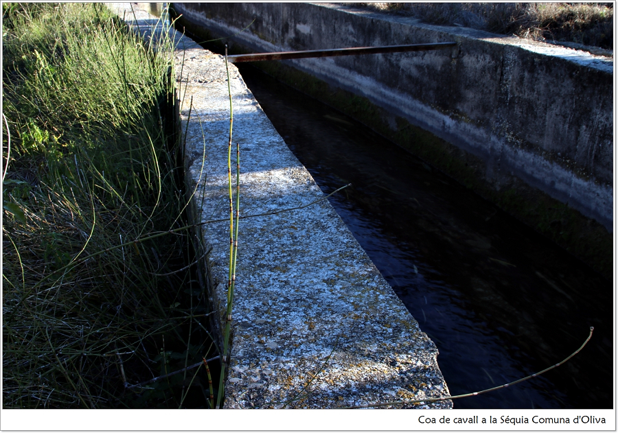
The horsetail
The stems of the horsetail are one of the most visible plants along this walk through the Sotaia paths. We can find them on the edges of roads, ditches and groves, wherever there is enough moisture. Its cylindrical herbaceous stems are formed by segments like superposed little tubes, rough to the tact.
Due to its high content in mineral salts, it has been used traditionally to strengthen the growth of nails and hair and as an effective diuretic and detoxifying plant. It has as well hemostatic and healing properties, suitable for excessive menstruation and nose bleeds. We can use it for both internal and external use, after boiling a handful of stems in a litre of water. We should not abuse it internally, since it may cause toxicity problems, and it is not recommended for pregnant women or children.
About it Pellicer said …herba dilecta i fins i tot la reina de les herbes remeieres… són singulars en la seua arquitectura, en l’antiguitat dels seus orígens i en la tria dels seus habitatges… més que qualsevol altre vegetal, poderoses fàbriques i caramulls magatzems d’una gran diversitat i abundor de sals minerals, essent molt riques en silici, potassa, calci i fòsfor, a més de magnesi, sodi, ferro i d’altres oligoelements… The silicon made by horsetail is the purest organic silicon and has the highest concentration rate. Within conventional agriculture it is a weed to remove; however, in organic farming it is used to strengthen plants and prevent some plagues.
Molí Canyar or Aynat Mill
Molí Canyar or Aynat Mill
It is located on the right bank of the river, in the Campina allotment. It received the waters from the Casa Clara bifurcation by the Oliva Common Canal.
The Aynat Mill, currently Molí Canyar, has been documented as a flour mill since at least the 15th century, and so it was until its extension and transformation, between the late 19th and early 20th centuries, simultaneously with the construction of the Alcoi-Gandia Harbour railway.
For centuries, it has been linked to an influential family of lawyers and administrators from la Font d’en Carròs, the Aynats. The old construction had to be replaced by a new building adapted to the transformation demands of the time, with the architectural characteristics of the late 19th century, but preserving its original underground structure. It is one of the few hydraulic mills in the right bank irrigation network that had a millpond.
In this new building, mechanisms for flour production were maintained, rice hullers and whiteners were incorporated, and electric turbines as well as steam and diesel engines were installed for electric provision. This was a manufacturing complex characteristic of the time, with large residential spaces for the workers’ families, administrative and office units and even workshops for the final packaging of the products, mainly rice. We find the remains of a chimney where the chaff was burned to produce the vapour used to help move the millstones.
Afterwards, the industry was expanded with an ice factory, attached to the northern wall next to the railway, which covered the ice supply needs of the Alcoi Gandia railway. This mill was restored and turned into a restaurant in 1998, but they have respected the original structure, and the primitive machinery and widgets are exposed to the public.
Oms, xops, lledoners i moreres entre d’altres donen la benvinguda al caminant.
About the elm trees Pellicer says: Alineats i enlairats, al capdamunt dels alts ribatges del gran caixer dels rius, on esbossen a voltes algun retall de bosquina o caramullant i afermant els marges de barrancs, afluents i fondalades humides, i voltant la majoria de les fonts dels faldars i d’algun dels alts vessants de les nostres muntanyes…
About the hackberries and their drupes: De tronc ferm esvelt i llis, color grisós i molt agradívol i copa ampla, frondosa, rotunda i molt brancuda (…) Els fruits, drupes o lledons, que pengen d’uns prims peduncles, maduren a les darreries de l’estiu o ja dins la tardor …
Torne del camp. L’horta és ara un vertader jardí, es vaja per on es vaja, es mire per on es mire. La blancor i el perfum de la flor del taronger ho inunden tot. Quina embriaguesa dolça i serena! A què s’assembla passejar per l’horta ara? És per a no creure-s’ho! No sols els tarongers, la fronda immensa de tarongers en flor, hi ha també els espinals en magnífica florida, solitaris o en denses colònies, encimbellats sobre els vells marges. La bracera despenjant-se florida i rosada. L’esclat de la valeriana roja. La florida dels caquiers. Les primeres flors de les queradilleres, bequerudes i aureolades, daurades i blaves, i dels Lathyrus, d’un color tan fresc, tan viu, que sembla que vagen a posar-se a volar. I la malvera estovada, pampolosa, alta i ben florida…
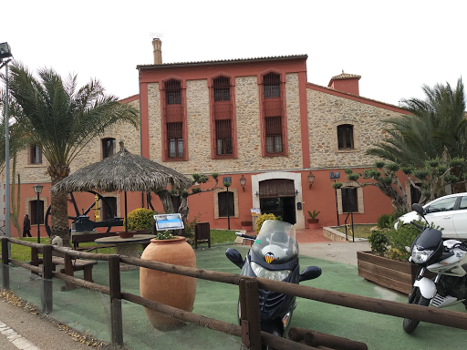
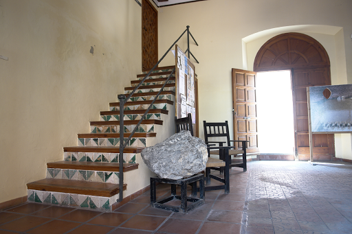
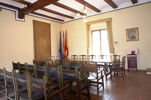
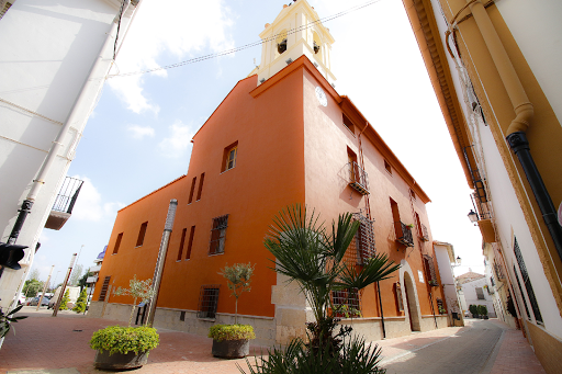
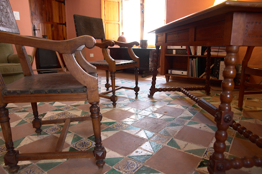
Manor House: Potries Town Hall
Manor House: Potries Town Hall
The Town Hall of Potries is a splendid example of 17th century stately architecture in the rural areas of our country. This old building preserves the original structure and layout, as well as some particular elements: magnificent polychrome ceramic pavements, large wooden beams, wrought iron fences, plasterworks…
The main facade is on the Boamit Street, a narrow and winding street reminiscent of the Muslim past of the town. This house-palace was built shortly before 1611, and was owned by the nobleman Pere de Borja i Centelles, the second son of the Duke of Gandia. At the end of the 19th century, the municipal corporation acquired this property from Domingo Llopis, a rich owner and industrialist dedicated to the silk business, and turned it into the headquarters of the Town Council. They installed the public clock, the prison, the schools for boys and girls, and the teachers’ dormitory.
 |
 |
 |